About DARTS-PL project

The aim of the DARTS-PL project is to develop a national database of test scenarios for autonomous vehicles (AVs), taking into account road conditions specific to Poland.
The project is carried out in a scientific consortium of the Motor Transport Institute (Leader) with the Faculty of Electronics and Information Technology of the Warsaw University of Technology.
DARTS-PL aims to:
- recording road scenarios containing specific examples of road sections in Poland, and then
- providing high-quality annotations for object classes registered in the material.
Each measurement section is recorded several times – in different weather, lighting and road conditions.
The database contains synchronized data samples from several types of sensors: IMU, GPS, cameras, lidars and radars. The project also develops an original method for providing annotations supported by artificial intelligence methods, data fusion, automatic detection and tracking of objects and active learning algorithms.
Annotations will be provided for e.g.:
- vehicles,
- pedestrians,
- bikers,
- other forms of transport on the road,
- infrastructure elements.
The project was financed by the National Centre for Research and Development under contract no. GOSPOSTRATEG-VIII/0001/2022. The entity supervising the implementation of the project is the Ministry of Infrastructure - Department of Transport Strategy.
Who can benefit from the database?
The DARTS-PL database is intended for engineers, technicians and companies dealing with automated vehicle control problems.
The aim of creating the DARTS-PL database is to increase the availability of high-quality data for use in scientific and development work. It can be used both as an element of developing methods for detecting and classifying objects in data sets (video, radar and lidar), as well as developing algorithms for planning and controlling automated vehicles. The database will be made available to interested entities on a non-profit basis.
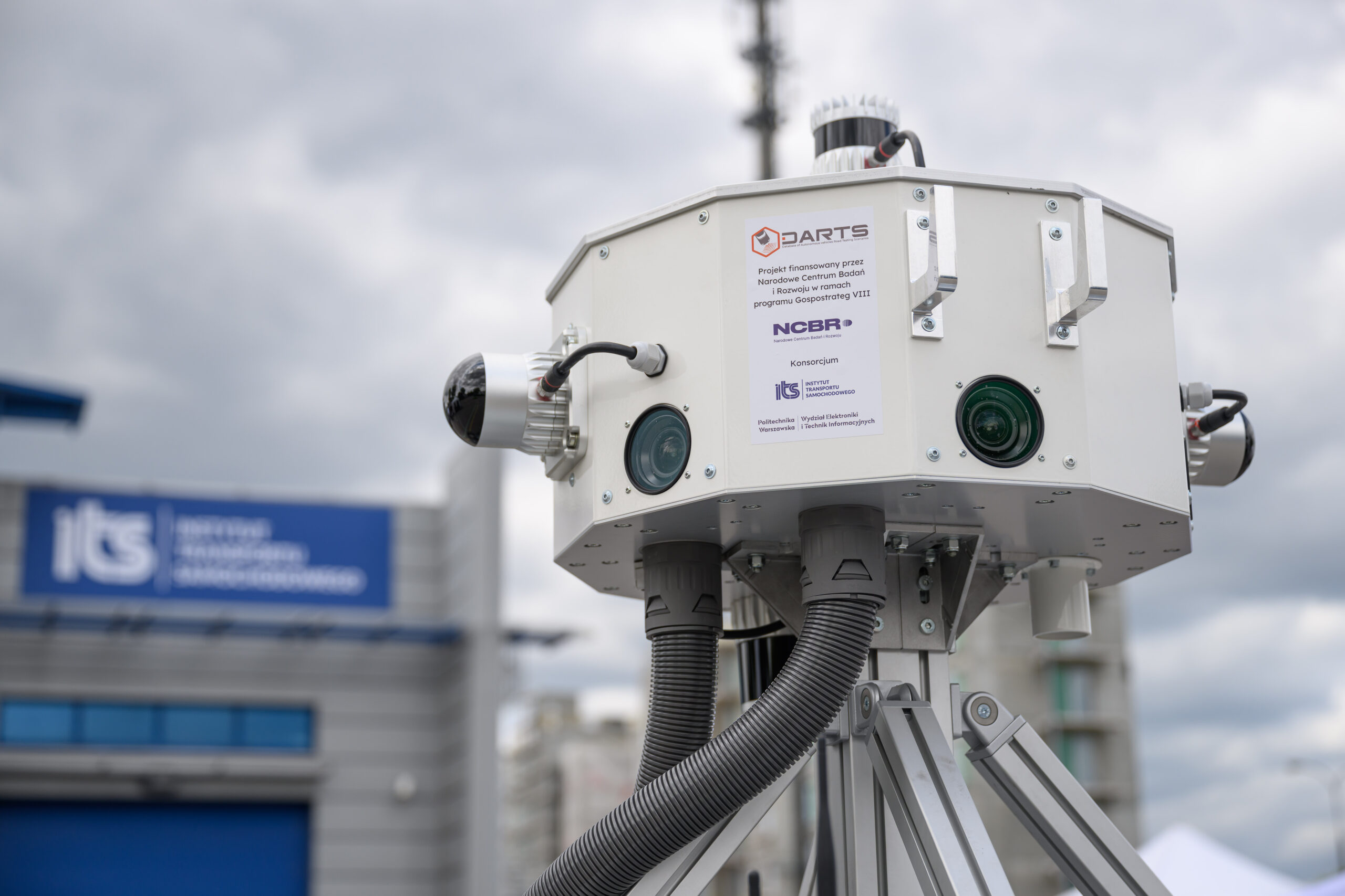
Measurement set
Superset of sensors.
Environment recording in 360°.
4
LiDARs
Ouster OS1 and Ouster OS2 placed centrally in the vehicle axis, covering 360° FoV
2 Ouster OS Dome placed diagonally at the side edges of the vehicle, so as to supplement the dataset with objects in the close distance from the measuring vehicle
2 Ouster OS Dome placed diagonally at the side edges of the vehicle, so as to supplement the dataset with objects in the close distance from the measuring vehicle
7
cameras
7 DS-CAM-640C cameras, 6 of which are arranged to allow for 360° observation around the vehicle, and one additionally directed centrally to more precisely record the area in front of the vehicle
6
RADARs
2 Smartmicro DrveGrd 169 radars recording the space in front of and behind the vehicle at a long distance
4 Smartmicro DrveGrd 152 radars placed in the corners of the vehicle
4 Smartmicro DrveGrd 152 radars placed in the corners of the vehicle
1
IMU-GPS-RTK module
Inertial measurement unit with a sampling rate of 1000 Hz, localization module (GPS) with an accuracy of 10 cm and RTK service
1
thermal imaging camera
The Optris IR camera, placed centrally in the vehicle axis, records the traffic situation in front of it, providing an additional source of data, especially needed in unfavourable weather conditions
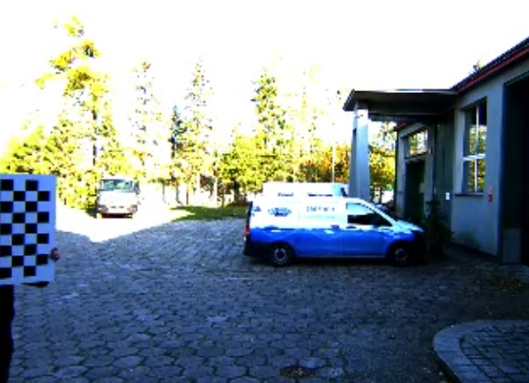
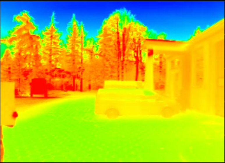
See how individual sensors perceive the environment

Scenario database
Do you need
more information?
Contact us!